
Fire departments in Fargo, ND and Billings, MT were among the first to sign early adopter agreements for LR-x®, and Bismarck, ND Fire Department requested one in 2018. Feedback from those departments and from captains at the Houston Fire Department went into the December 2018 update that added address search and share links.
One picture for everyone on the incident
Response team members can send police, the EOC and other agencies a link to the 3D wind field, the chemical, current conditions and forecasts. Receivers can view it on a phone or tablet and toggle the modeled wind, the 5 m and 50 m layers and nearby Tier II chemical locations. No account or app is needed on their end.
Traffic and perimeter control
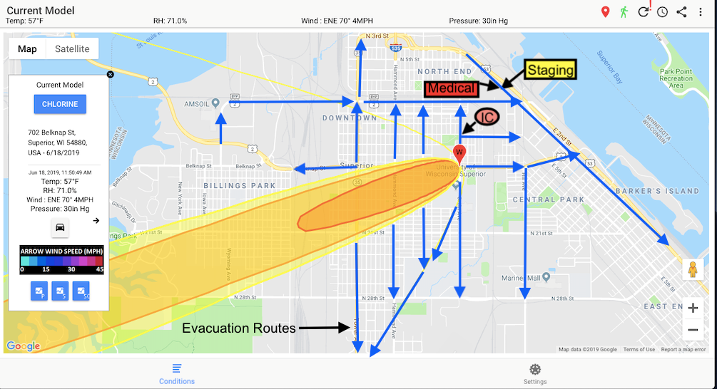
Turning on the traffic layer in the current-conditions model shows which roads fall inside the impact zone and how road closures are changing traffic flow, which helps when securing a perimeter and keeping travelers out of the plume. The map can also be captured as a screenshot and marked up with staging areas and barricades before sharing.
Training
What-if scenarios use the same screens as live incidents, so crews can practice with realistic parameters and review the runs afterwards in Model History.